Things to do nearby
Villa Mañihuales sits on the Carretera Austral, roughly halfway between Coyhaique and Puyuhuapi. Here's what there is to explore nearby, gathered from public tourism sources, CONAF, and accounts from cyclists who've passed through here. Distances are approximate, and schedules, prices, and access can change — worth confirming before you head out, especially in high season.
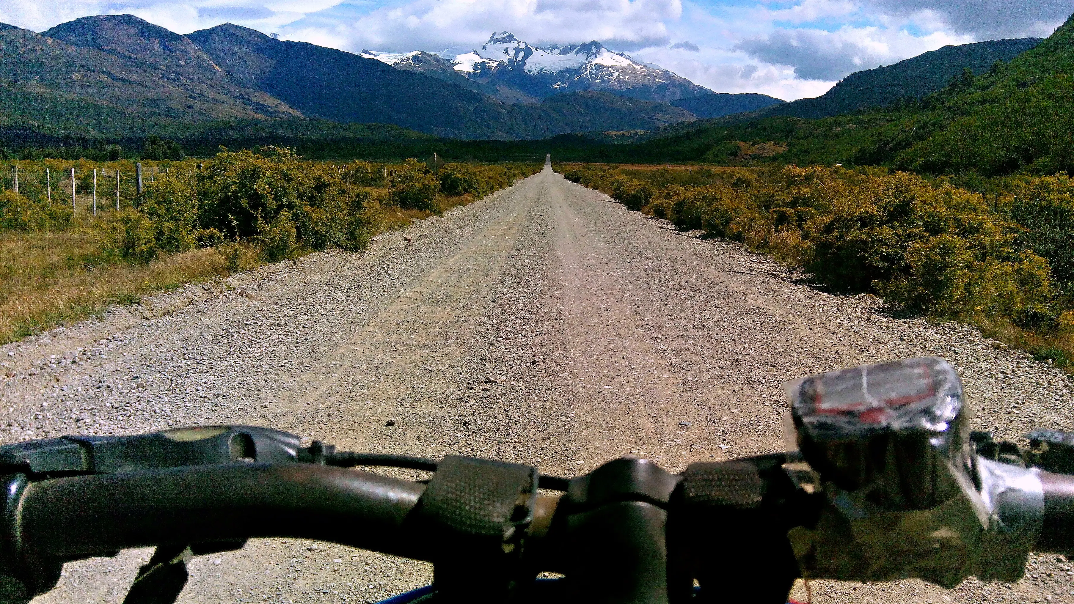 Reference photo, not taken in Mañihuales
Villa Amengual · La Junta · Puyuhuapi
Paved as far as Villa Amengual, a small town with lunch spots, coffee, and the southern entrance to Queulat National Park. After that comes Cuesta Queulat: gravel with tight curves following the Cisnes River, a demanding and much-photographed stretch on the way to Puyuhuapi.
Coyhaique
A mix of pavement and gravel, with more traffic and dust on the final stretch before the city. Many cyclists prefer the detour via the road to Puerto Aysén (X-50 / Route 240) shortly after Mañihuales: about 20 km longer, but in better condition and with views many describe as the best on the whole route.
Parks and nature reserves
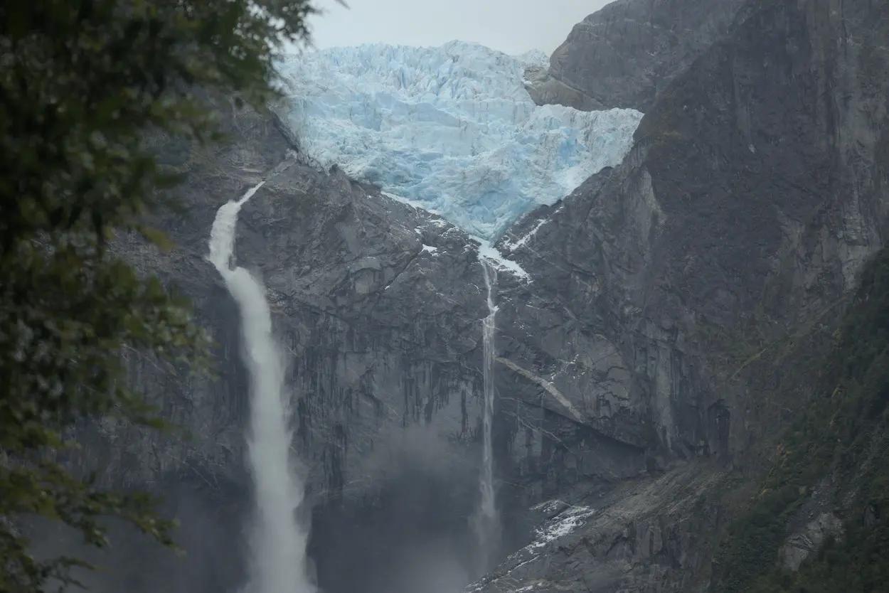
Queulat National Park — Hanging Glacier
The best-known hanging glacier on the Carretera Austral, with ice waterfalls cascading into a lagoon. Several short trails (20–40 min) and one longer one to Laguna Los Pumas (5 h). It's worth checking the trail and campground status before you go, since they can have temporary closures for works or weather.
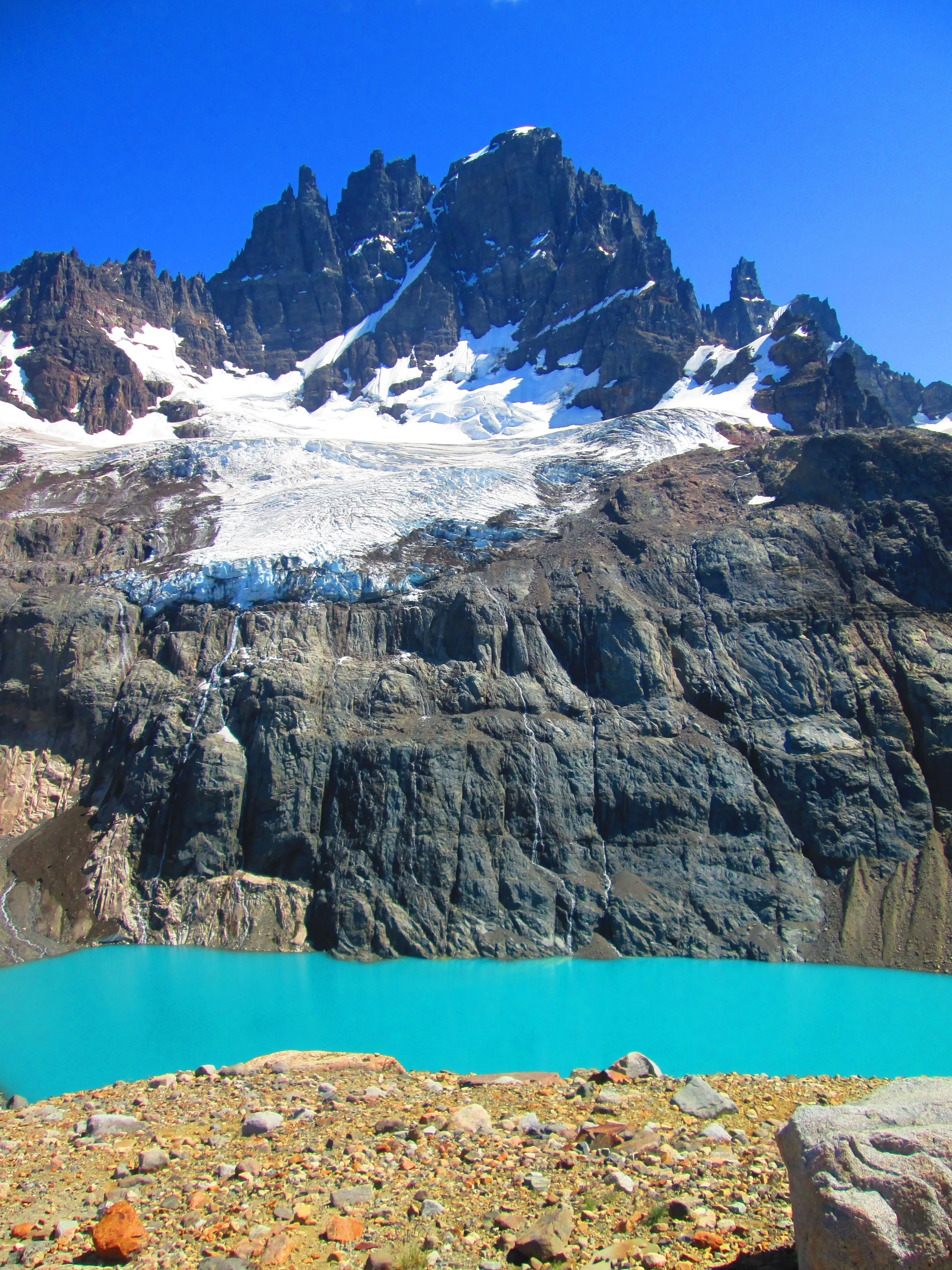
Cerro Castillo National Park
Granite towers that give the park its name, and huemul deer habitat. Several long trails require a certified guide and advance booking — check the park's official site before planning your visit, especially in high season.
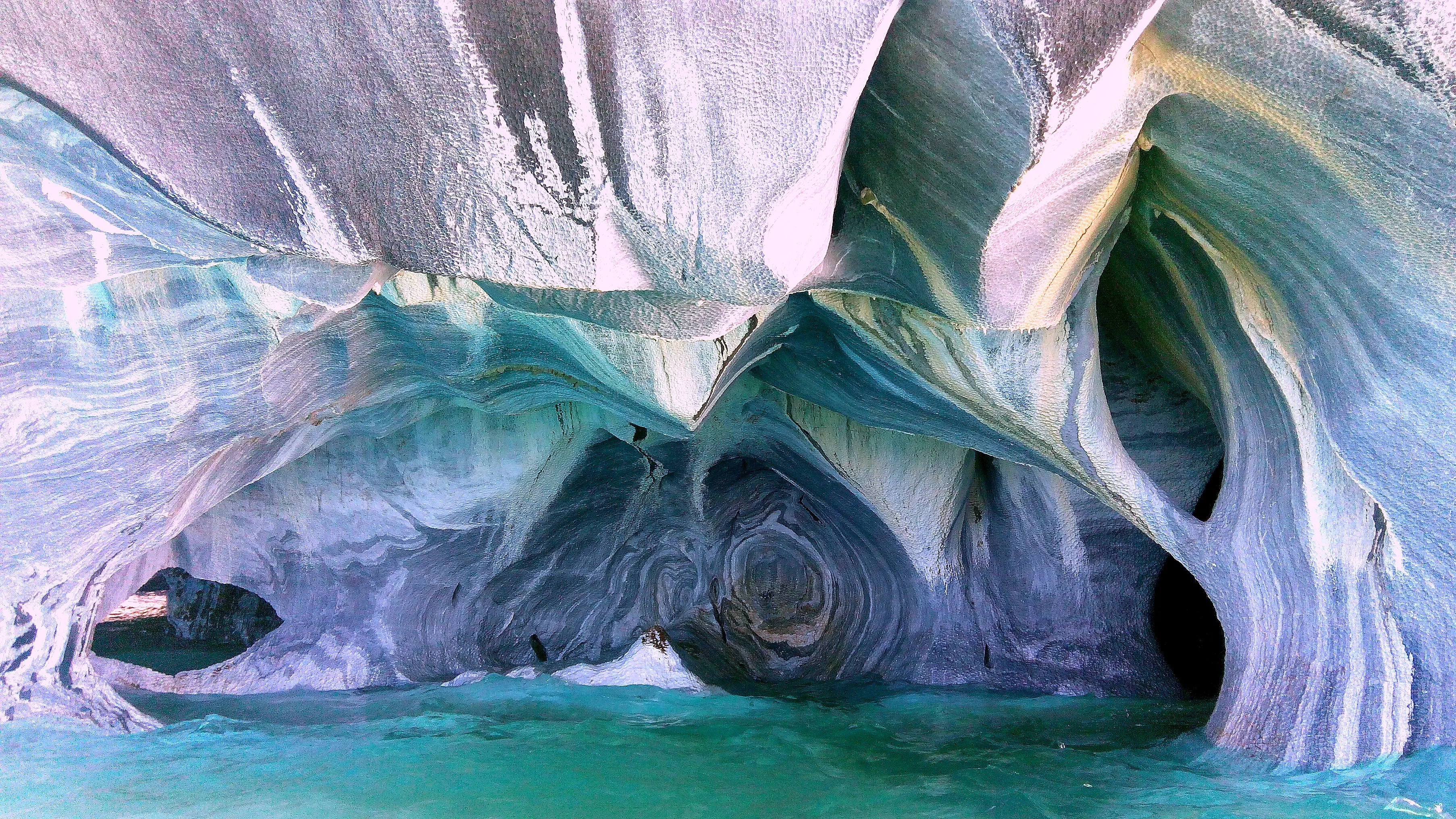
Marble Caves, Puerto Río Tranquilo
Marble formations carved by Lago General Carrera, visited by boat or kayak with local operators from town. Too far for a day trip from Mañihuales — worth it if your journey continues further south.
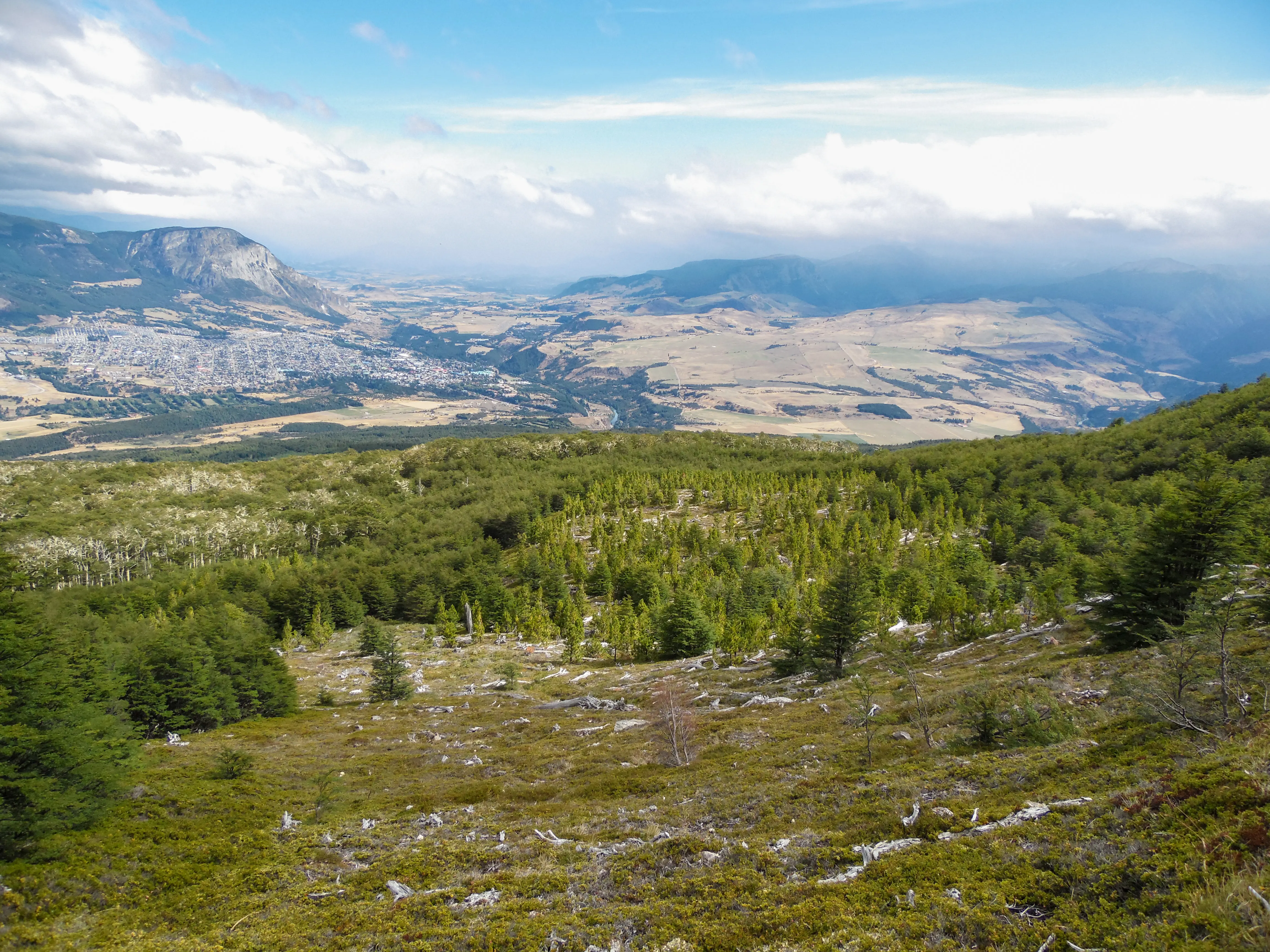
Coyhaique National Reserve
The most complete option for a half-day visit: eight short trails through lenga and ñirre forest, lagoons, and a panoramic viewpoint over the city. Most are easy and under an hour.
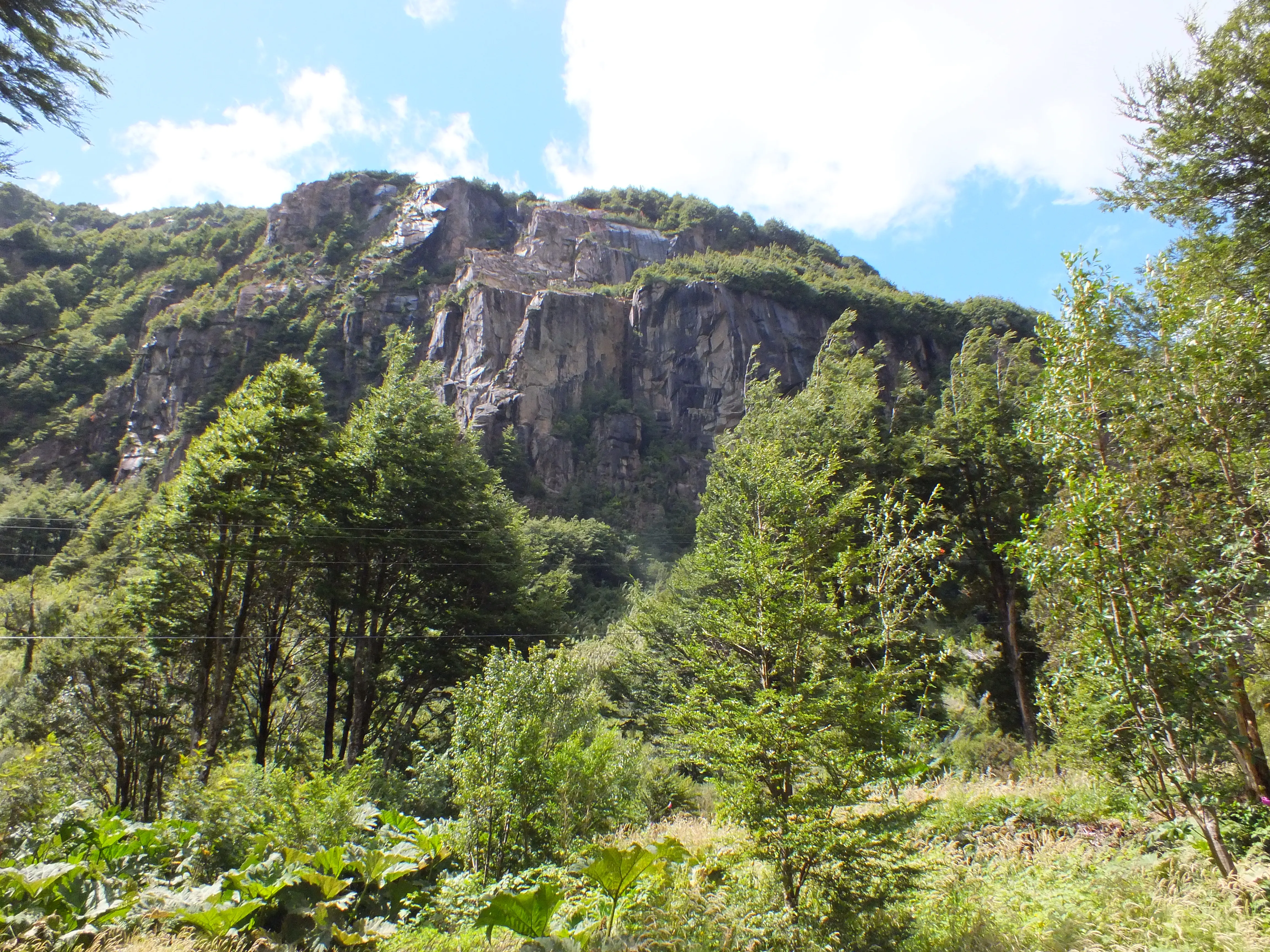
Río Simpson National Reserve
The Pioneros trail follows the river to La Virgen Waterfall, right next to the road. A classic spot for fly fishing and condor sightings.
Rivers and fly fishing
Río Mañihuales
Brown trout, rainbow trout, and salmon (coho and king, which run upstream to spawn in March–April). A good river for float fishing thanks to its bends and fallen logs. Catch-and-release only.
Río Ñirehuao
A tributary of the Mañihuales — where the two meet, they form the Río Aysén. Also known as the "grasshopper river" for how common the insect is along its banks. Common trout in good numbers, a calm river running through the Ñirehuao Valley.
Río Simpson
One of Patagonia's best-known fly-fishing rivers, with established operators and guides in Coyhaique.
Hot springs
Puyuhuapi Hot Springs
The best-known hot springs in northern Aysén, reached by boat. Worth checking prices and availability directly on their site, since they vary quite a bit between high and low season.
Termas El Sauce
Simpler natural hot springs, down a roughly 4 km gravel detour from the main road before reaching La Junta.
Viewpoints and Lago Las Torres Reserve
Mañihuales Viewpoint Circuit
The closest viewpoint of all: a rocky outcrop with a great view over where the Ñirehuao and Mañihuales rivers meet, with a waterfall just before the top. The trail starts on a faint old track (under 1 km), continues through wetland meadows, and ends on a well-marked pioneer trail. Fox tracks and condors have been spotted in the area; you can return via a gentler route along the Ñirehuao.
Lago Las Torres National Reserve
The nearest protected area to the campground by vehicle, with the El Diablo viewpoint overlooking the lake. A good short stop heading north; CONAF warns of landslide risk in certain sectors, so check in at the entrance before heading past the viewpoint.
Cerro El Colmillo
A trekking trail through a huemul deer protection zone, with different variants depending on how much time you have — some require a full day and good fitness.
Piedra del Indio
A rock formation visible from the road, a classic landmark on the way south.
Las Lavanderas Natural Urban Park
A local park along the Las Lavanderas creek, with short trails, a playground, local-product stalls, and a small open-air museum of settler tools. Ideal for a short walk without leaving town.
Towns along the way
Villa Amengual
A small town with local shops, a health post, and lodging — the gateway to Queulat National Park and Lago Las Torres National Reserve.
La Junta
"The meeting-point town," where the Palena and Rosselot rivers meet. It has a gas station, supermarkets, a mechanic's shop, and lodging — a good place to restock if you're continuing north.
Coyhaique
The regional capital, with every service you'd need: banks, supermarkets, gas stations, hospitals, and the nearest airport (Balmaceda). The usual base for trips to Cerro Castillo, Queulat, and Lago General Carrera.
Puerto Aysén
An urban center on the fjord, with the Presidente Ibáñez Bridge as its landmark. The road there is the same one many cyclists prefer for heading down to Coyhaique, thanks to better road conditions and fjord views.
Villa Ortega
A small town right on the Carretera Austral, next to the Mano Negra creek. Road X-445 branches off here toward the Trapananda and Ñirehuao national reserves. Across the way is Cerro Rosado, home to a petrified forest, and the town has a small Settlers' Museum.
La Tapera
The capital of the Lago Verde commune until 1988. A small town but with basic services: a police station, a rural health post, and a Civil Registry office — useful as a support point if your trip detours east.
Puerto Cisnes
A coastal town on a fjord, where small-scale fishing is a big part of local identity. A good detour if your trip includes the coast as well as the main route.
This information was put together from official sources (CONAF, national parks), Aysén tourism outlets, and accounts from cyclists who've ridden this same route. It doesn't replace official information for each place — if you have questions planning your trip, write to us and we'll help with what we know.
Photo credits
- Cover photo — Cycling the Carretera Austral — photo by Nicolás Lara, CC BY-SA 3.0, Wikimedia Commons
- Hanging Glacier, Queulat — photo by Huincul, CC BY-SA 4.0, Wikimedia Commons
- Cerro Castillo — photo by Manxuc, CC BY-SA 4.0, Wikimedia Commons
- Marble Caves — photo by Nicolás Lara, CC BY-SA 3.0, Wikimedia Commons
- Coyhaique National Reserve — photo by Natalia Reyes Escobar, CC BY-SA 4.0, Wikimedia Commons
- Río Simpson National Reserve — photo by Maokru, CC BY-SA 4.0, Wikimedia Commons